Brief History
Taraba State is a Nigerian state, located in the northeast region of the country with 16 local government areas, the state was initially created with 10 local government areas in 1991 which was later extended to 16 local government areas and now the state has two new Special Development areas. Taraba state was carved out of the former Gongola State in August 27th, 1991. The capital of Taraba State is Jalingo (The word “Jalingo” meaning “Superior Place” in Fulfulde); the city is mainly dominated by Fulani and other small ethnic groups. It is the traditional city of Muri Emirate, the town was founded during the Fulani Jihad under the Sokoto Caliphate. Muri Emirate Council is the current traditional institution inside the city boundaries of Jalingo, and under the authority of the Government of Taraba State. What is now Taraba State has been inhabited for years by various ethnic groups, including the Fulani, Jukun, Chamba, Kuteb and Ichen in the southern part of the state; Wurkum, Mumuye and Kona in the northern part; the Mambilla, Fulani, Chamba and Jibawa in the central region; There are over 80 different tribes and their languages in Taraba State. Of the 36 states, Taraba is the 3rd largest in area and thirty-three most populous with an estimated population of over 2,294,800 as of 2006 cansus. Taraba state is named after Taraba River which traverses the southern part of the state, and nicknamed as “Nature’s Gift to the Nation”. The major ethnic groups living in Taraba State are the Fulani, Kuteb Chamba, Yandang, Mumuyes, Mambila, Wurkums, Janjo, Jukun, Ichen, Tiv, Pena, Kambu, Kodei, Vute, Hausa and Ndola. The major occupation of the people of Taraba State is agriculture. Cash crops produced in the state include coffee, tea, groundnuts and cotton. Crops such as maize, rice, sorghum, millet, cassava and yam are also produced in commercial quantity. In addition cattle, sheep and goats are reared in large numbers, especially on the Mambilla Plateau and along the Benue and Taraba valleys. Similarly, the people undertake other livestock production activities like poultry production, rabbit breeding and pig farming in fairly large scale. Communities living on the banks of River Benue, River Taraba, River Donga and Ibi engage in fishing all year round. Other occupational activities such as pottery, cloth-weaving, dyeing, mat-making, carving, embroidery and blacksmithing are also carried out in various parts of the state.
Festivals and Traditions
- Taraba State is endowed with a rich cultural heritage culminating in the existence of a variety of traditional festivals which are celebrated as an annual community affair throughout the various local governments. The important festivals celebrated in the State include the following:
- MINHU Hunting Festival: The major cultural festival of the Jen people is a hunting festival referred to as ‘Minhu’ hunting festival, is celebrated annually every first week of May. This festival is held in Karim-Lamido L.G.A. It is recognized by the Taraba state Government as a major festival.
- Kuchicheb Festival: The Kuchicheb festival is a thanksgiving festival for the good harvest, normally held on 25th March each year among the Kuteb people in Takum Chiefdom, Ussa and Takum Local Governments Areas, Southern Taraba State.
Tourists Attractions and Locations
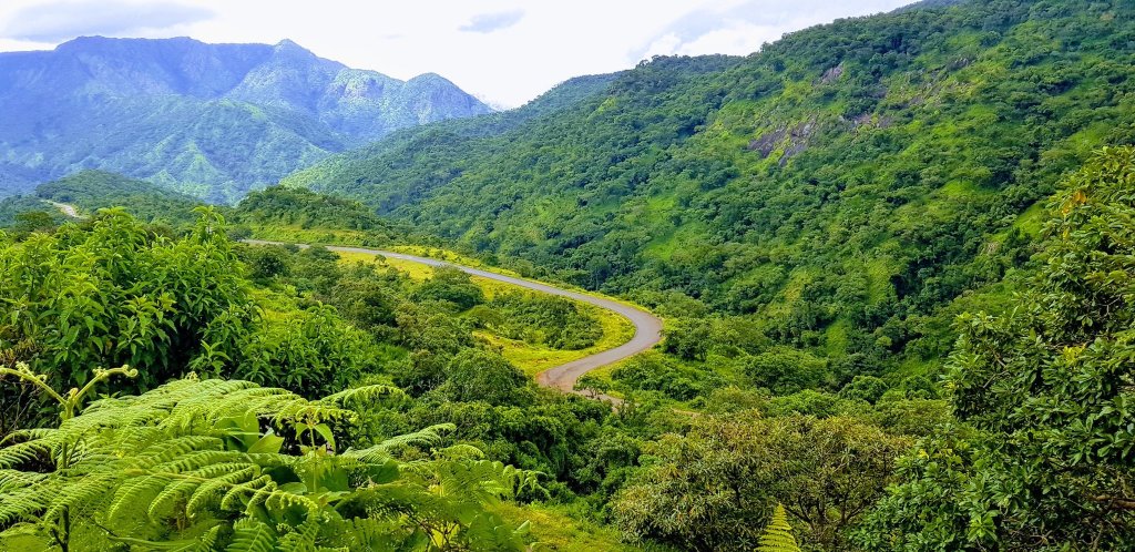
- Mambilla Plateau: The Mambilla Plateau is a plateau in Gembu, Sardauna L.G.A of Taraba State, Nigeria. The Mambilla Plateau is about 1,600 metres above sea level and arguably the highest mountain points in Nigeria. The Mambilla is Nigeria’s northern continuation of the Bamenda Highlands of Cameroon. Mambilla plateau is comparatively cold. Daytime temperatures hardly ever exceed 25 °C (77.0 °F) making it the coolest region in Nigeria. As soon as you reach the top of the mountain, the hot weather witnessed at the foot of the mountain disappears as you are welcomed to a fresh and very chilled breeze blowing across the plateau. Mambilla is also home to the Mambilla tea plantations, Located In Kakara town of the state.
- Gashaka-Gumti National Park: Gashaka-Gumti is the Nigeria’s largest national park in Nigeria,
Gashaka-Gumti National Park is located in the mountainous region of north-eastern Nigeria
adjacent to the international border with Cameroon, towards the north of Mambilla Plateau
covering a total area of 6,731 sq.km both in Adamawa and Taraba States, the Park is contiguous
with Faro and Tchabal Mbado National Parks in the Republic of Cameroon. Gashaka-Gumti Park
experiences varying pleasant weather conditions, depending on one’s location within the Park.
These range from tropical dry humid, tropical moist humid in the lowlands to sub-tropical
highland weather on the high plateau around Chappal waddi, Sabere and Fillinga. The Northern
Gashaka-Gumti sector is flat and home to large savannah animals such as elephant, hyena, wild
dog, lion, roan antelope and the giant eland. This reserve parades the largest and richest reserve
south of the Sahara. It contains various flora and fauna with varied bird viewing possibilities. No
roads cross this remote region and only a few lonely footpaths wind through the forested
mountains towards Cameroon

